


Site Search
Increased value through the promotion of BIM
- TOP
- Business Introduction
- List of services and solutions provided
- Increased value through the promotion of BIM
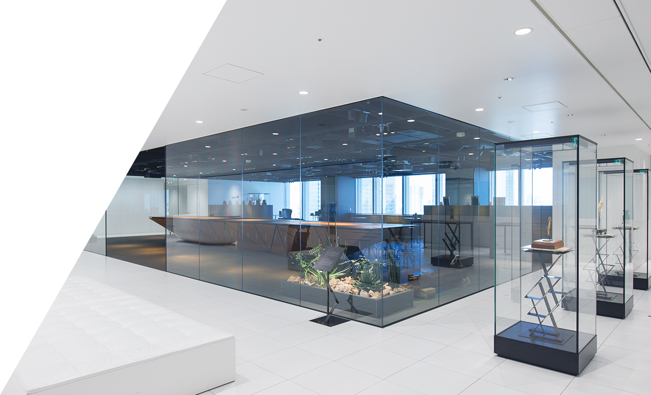
As part of its efforts to promote BIM (Building Information Modeling), Tanseisha introduced the BIM software "Revit" in 2016 and launched the company-wide "BIM Promotion Committee" in 2020.
Since then, the entire company has been working to promote its use in key processes of space creation, from design and construction to maintenance.
BIM is a technology that can add attribute data such as the specifications and performance of materials and components, finishes, and management information to 3D models, and can be used widely to streamline various tasks. In order to further promote its implementation, Tansei released its own guidelines, the Tansei BIM Platform, in February 2024, including the establishment of a production and utilization base and the development of automation tools. Based on these, Tansei connects the entire business process, including the supply chain, and promotes the proposal, Design, Layout, production, and construction of a wide range of properties.
For inquiries regarding space creation using BIM or suggestions for technical information, please contact us using the information below.
Tansei BIM Platform
BIM is a workflow that adds information to 3D models and utilizes them not only for design but also for operation. A database of buildings is generated by adding "attribute data" such as cost, finish, and management information to a 3D digital model of a building created on a computer, and this information can be used in every process from architectural design and construction to maintenance. As we advance space creation using BIM, we are building our own unique platform, the "Tansei BIM Platform," for more effective use of BIM in line with the characteristics of our business.
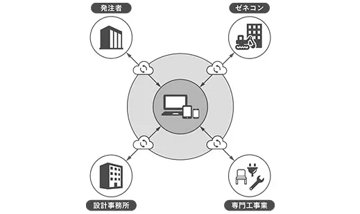
Relationships with partner companies
| 2022.09.08 |
|
|---|---|
| 2024.03.12 |
|
| 2025.03.25 |
|
Examples of BIM x design use
In order to provide high-quality, highly accurate designs and planning, we use 3D visualization to visualize the design, which helps to reach a consensus with the client and ensure smooth business outsourcing.
Examples of BIM x production use
By proactively using 3D scanners to obtain point cloud data during on-site surveys, we can efficiently carry out highly accurate surveys in a short time, which leads to cost reduction. In addition, by recording information on complex shapes and high places such as ceiling equipment in 3D, we have introduced 3D simulations from the upstream of the design stage.
Point cloud data acquired by a 3D scanner
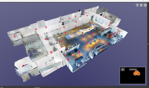
For site management, the on-site situation can be photographed with a 360° camera, allowing for confirmation like a street view, and progress can be checked remotely. In addition, since it is possible to link on-site images with BIM data modeled from point clouds, we are working to realize a digital twin using site management tools and enable highly accurate design supervision and construction management.
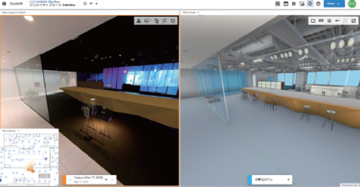
Digital twin with site management tools
Collaboration between BIM and data utilization
Starting with internal collaboration between sales, design, and production, we are able to share data (information) with partner companies, general contractors, equipment companies, developers, and clients through the cloud, which allows for smooth communication and leads to improved business efficiency.
It has excellent information export functions, so exporting summary table data is useful for various operations. In addition, by utilizing the equipment interference check function, interference with fitting parts that cannot be noticed in 2D can be corrected at the design stage, so errors can be found early and costs such as labor and material costs that would be unavoidable during construction can be reduced.
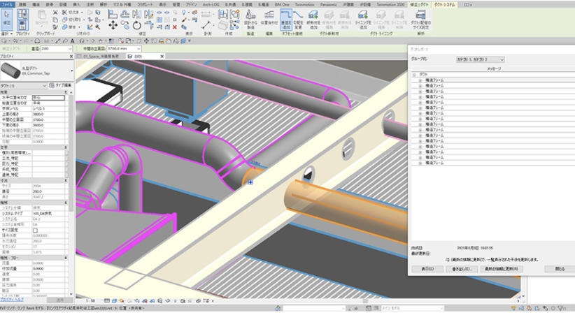
Problems with the relative positions of equipment and fitting that are difficult to notice on a floor plan can be discovered early on in the 3D model.
New value proposition in promoting BIM
Through the common language of BIM, we will continue to create further innovation and provide new value to our clients.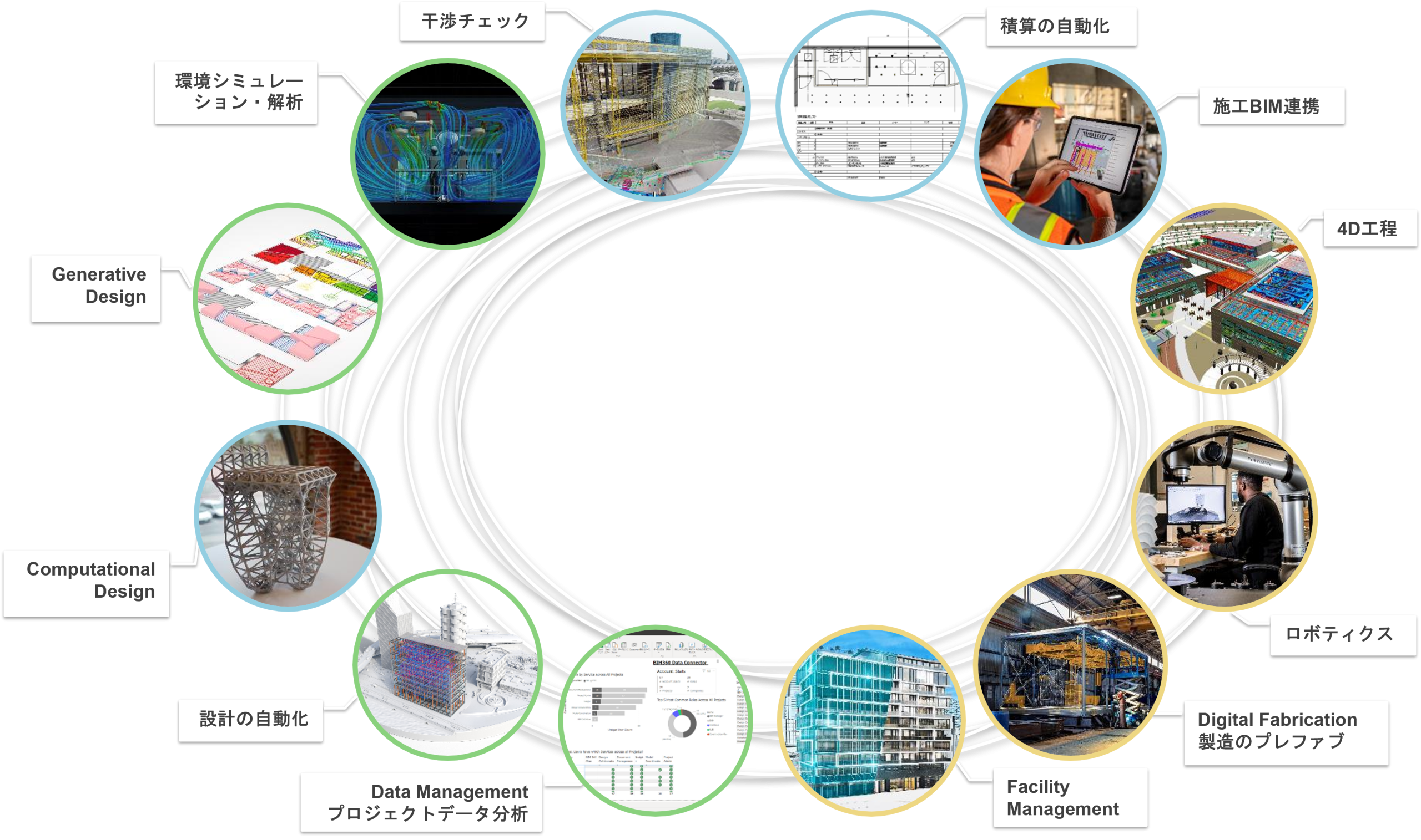

Services provided:
Solutions List
NFT projects
We will create new experiential value by producing compelling NFT content.
Interactive information viewing system "VisualTiles®"
Supports information viewing and presentation in various communication spaces
Development of new materials and products that focus on sensibility
We are co-developing "Posica® Clear™ Film" with Mitsui Chemicals, Inc. to make the world more beautiful
Creating a real and virtual space
We will create new communication by creating spaces that take into account the characteristics of both the real and digital worlds.
"FAC+" - a spatial data analysis service that maximizes spatial value
Combining data analysis and design, we help maximize the value of your space.
"VR Ceremony" is a virtual ceremony space that can be held any time and place.
We will create a new opportunity for communication in a virtual ceremony space that can be held any time and place.
Digital interactive sports game "AIR Air Hockey"
Non-contact digital sports help stimulate communication in the office
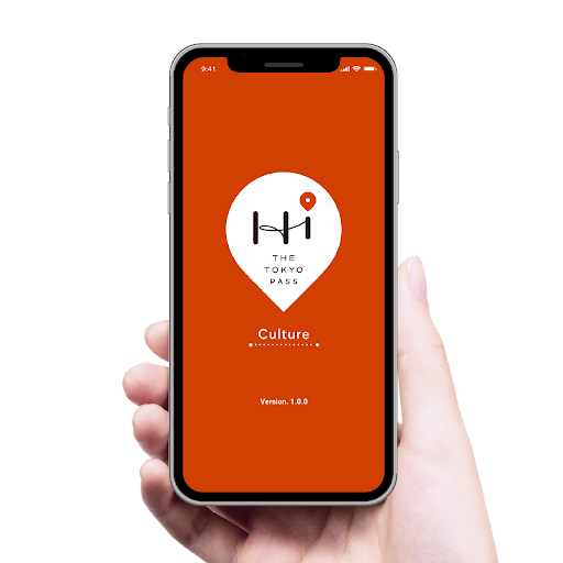
THE TOKYO PASS
We operate a service aimed at foreign visitors to Japan to make their cultural Tourism in Tokyo more comfortable and enriching.

"saguroot" - A knowledge management tool that uses AI
A tool for finding in-house knowledge and talent, developed for R&D, innovation and planning organizations and companies.
COCOSTAT is a spatial data analysis service that allows you to understand how space is being used while respecting privacy.
We support spatial data utilization by acquiring data effectively and efficiently according to the environment and purpose.